Good progress at 1st Annual Progress meeting of the new EMODnet HRSM project
27 October 2017
The full consortium of the new phase for EMODnet Bathymetry "High Resolution Seabed Mapping - HRSM" met at their 1st Annual Progress meeting 25 – 26 October 2017 at HCMR offices in Heraklion, Crete, Greece.
Good progress was reported with the priority activities for the 1st year concerning the gathering of new survey datasets and composite DTMs and including these in the EMODnet Bathymetry metadata catalogues. In the first 10 months of the new project phase already > 6.000 CDI entries for survey datasets have been added, bringing the grand total > 20.000. This has been achieved by 31 data providers of which 4 are new to the consortium. Many more CDI entries are expected in the coming weeks, in particular by new data providers that are adopting well the EMODnet standards and procedures.
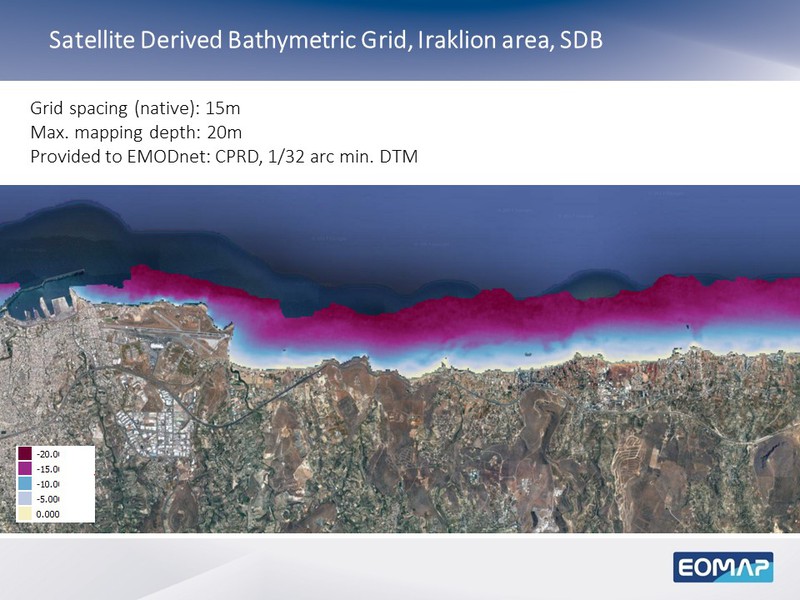
This phase also use will be made of Satellite Derived Bathymetry (SDB) datasets, in particular using Landsat 8 and Sentinel-2 satellites. Also contributions are received from the BASE-Platform project which provides satellite derived bathymetry data on a global scale while also using tidal modelling and crowdsourced data collection techniques to enhance accuracy. The SDB datasets will be used for complementing coverage in coastal waters, where possible. An excellent example was presented by partner EOMAP for the Cretan coast near the meeting place in Heraklion.
All the data gathering and processing must lead to the release of a new EMODnet DTM with a higher overall resolution around mid 2018.